File:MapCorundyCulturalRegions.jpg
Jump to navigation
Jump to search

Size of this preview: 800 × 591 pixels. Other resolutions: 320 × 237 pixels | 1,082 × 800 pixels.
Original file (1,082 × 800 pixels, file size: 161 KB, MIME type: image/jpeg)
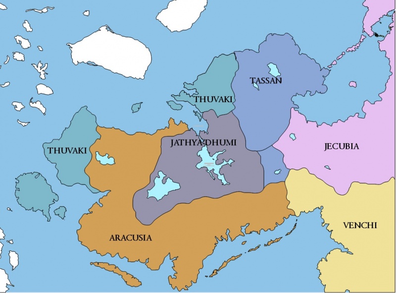
Corundy Regional Map Screen Capture, ©2017 Kraig Hausmann, All Rights Reserved
File history
Click on a date/time to view the file as it appeared at that time.
| Date/Time | Thumbnail | Dimensions | User | Comment | |
|---|---|---|---|---|---|
| current | 11:54, 29 September 2017 | | 1,082 × 800 (161 KB) | Trismegistus (talk | contribs) | Corundy Regional Map, Screen Capture, ©2017 Kraig Hausmann, All Rights Reserved |
| 11:27, 29 September 2017 | 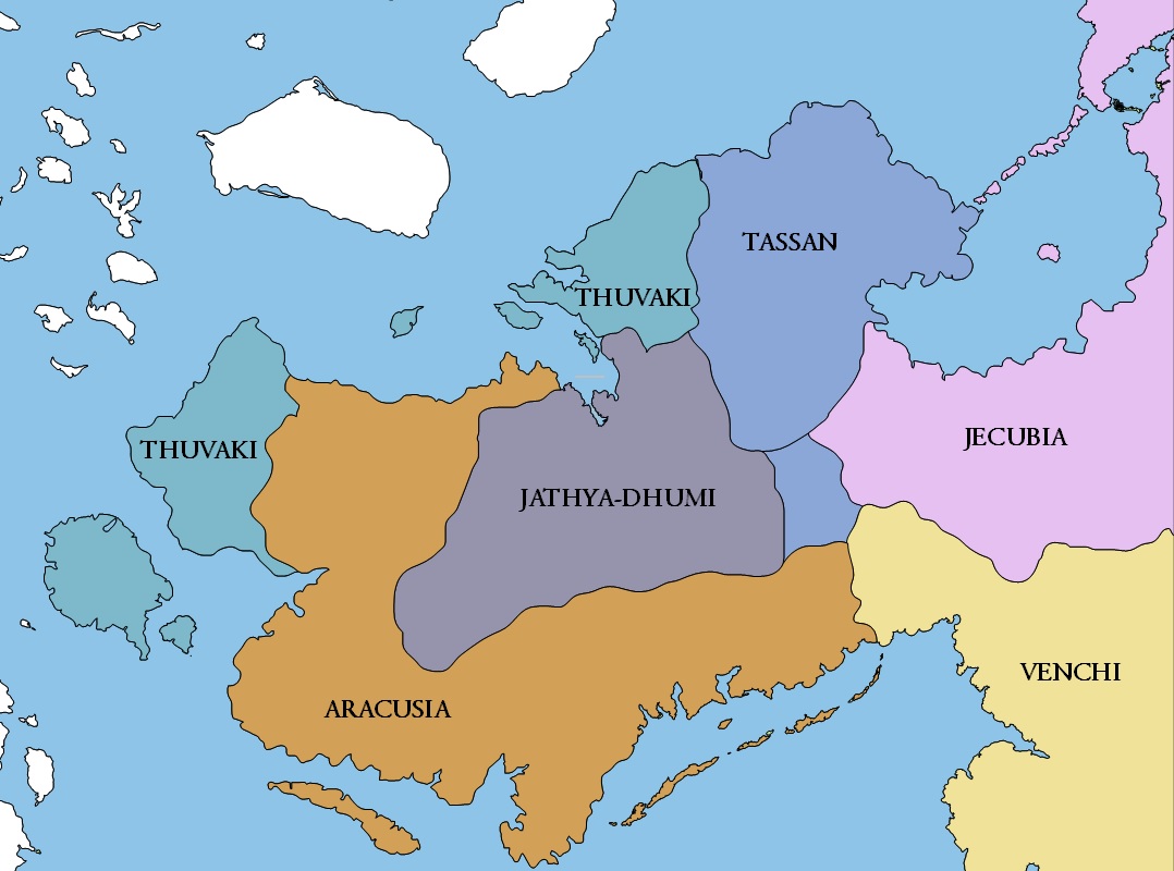 | 1,078 × 800 (142 KB) | Trismegistus (talk | contribs) | Corundy Regional Map Screen Capture, ©2017 Kraig Hausmann, All Rights Reserved |
You cannot overwrite this file.
File usage
The following 5 pages use this file: