File:MapPoliticalIthrads.jpg
Jump to navigation
Jump to search
Size of this preview: 800 × 442 pixels. Other resolutions: 320 × 177 pixels | 1,476 × 816 pixels.
Original file (1,476 × 816 pixels, file size: 547 KB, MIME type: image/jpeg)
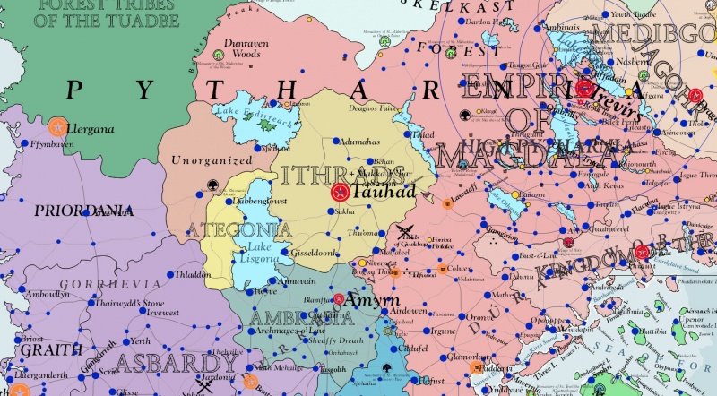
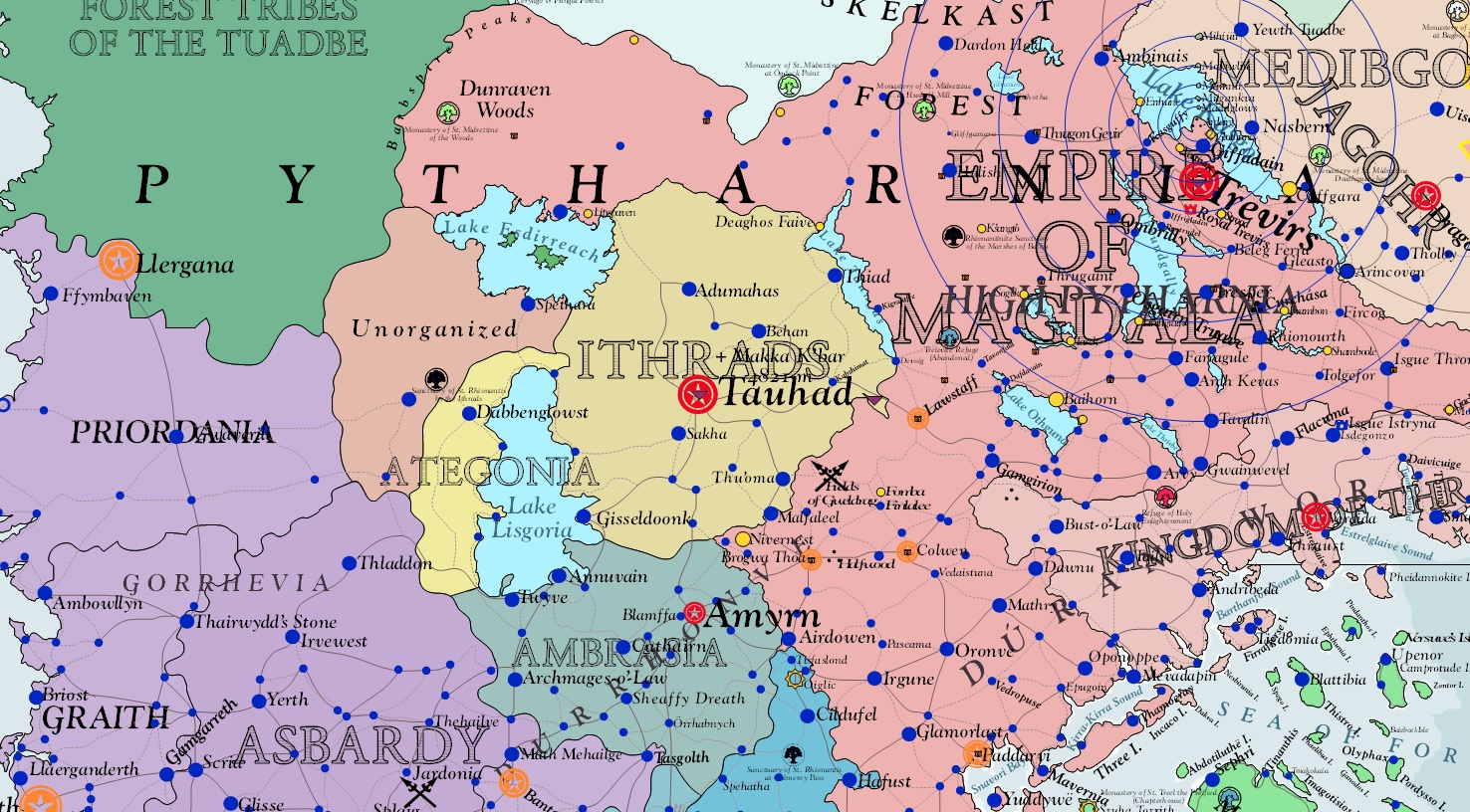
Asdarah Map Capture, Commonwealth of the Ithrads shown with neighboring states
File history
Click on a date/time to view the file as it appeared at that time.
| Date/Time | Thumbnail | Dimensions | User | Comment | |
|---|---|---|---|---|---|
| current | 17:58, 22 March 2014 | | 1,476 × 816 (547 KB) | Trismegistus (talk | contribs) | Asdarah Map Capture, Commonwealth of the Ithrads shown with neighboring states |
You cannot overwrite this file.
File usage
The following page uses this file: