File:MapGonfaloyTopo.jpg
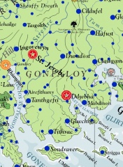
Revision as of 21:41, 29 November 2013 by Trismegistus (talk | contribs) (Screen capture from Asdarah Map, Territory of the historic land of Gonfaloy)

Size of this preview: 440 × 599 pixels. Other resolutions: 176 × 240 pixels | 551 × 750 pixels.
Original file (551 × 750 pixels, file size: 196 KB, MIME type: image/jpeg)
Screen capture from Asdarah Map, Territory of the historic land of Gonfaloy
File history
Click on a date/time to view the file as it appeared at that time.
| Date/Time | Thumbnail | Dimensions | User | Comment | |
|---|---|---|---|---|---|
| current | 21:41, 29 November 2013 | | 551 × 750 (196 KB) | Trismegistus (talk | contribs) | Screen capture from Asdarah Map, Territory of the historic land of Gonfaloy |
You cannot overwrite this file.
File usage
The following page uses this file: