Uploads by Trismegistus
Jump to navigation
Jump to search
This special page shows all uploaded files.
| Date | Name | Thumbnail | Size | Description | Versions |
|---|---|---|---|---|---|
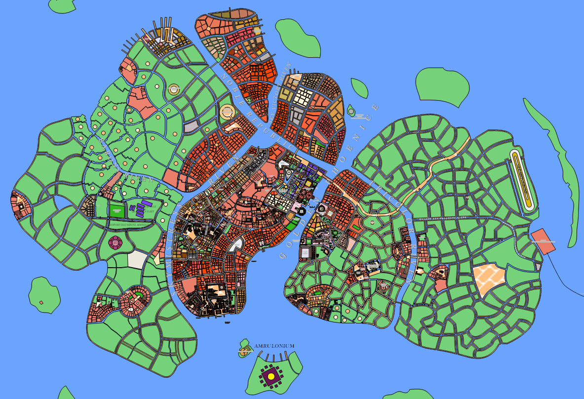
| 18:35, 27 October 2013 | AuriceCity Overview 2750 WIP 001.jpg (file) |  |
436 KB | Screen Capture of Islands of City of Aurice from Aurice City Map, ca 2750. | 1 |
| 18:30, 27 October 2013 | Trevirs-West 2750 001.jpg (file) |  |
281 KB | Screen Capture of Western districts of Trevirs, ca 2750, including Iblatha Barrhuig, from regional map, 11-4. | 1 |
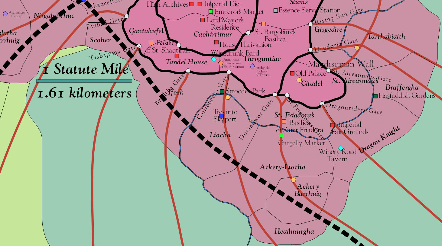
| 18:28, 27 October 2013 | Trevirs-South 2750 001.jpg (file) |  |
222 KB | Screen Capture of districts of southern city of Trevirs, ca 2750, from regional map. | 1 |
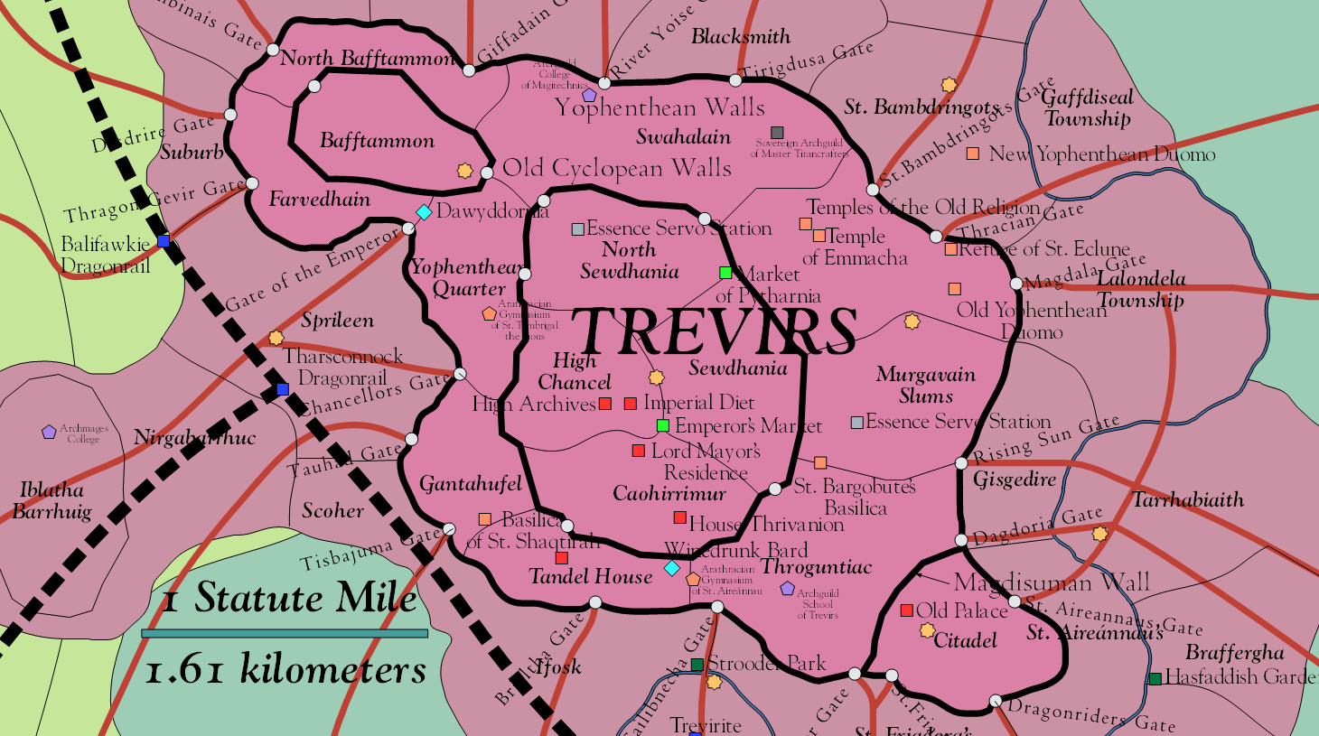
| 18:27, 27 October 2013 | Trevirs-Mid 2750 001.jpg (file) |  |
292 KB | Screen Capture of central districts of city of Trevirs, ca 2750, from regional map. | 1 |
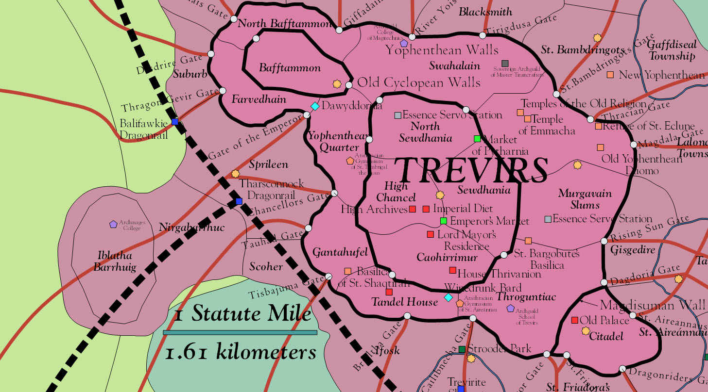
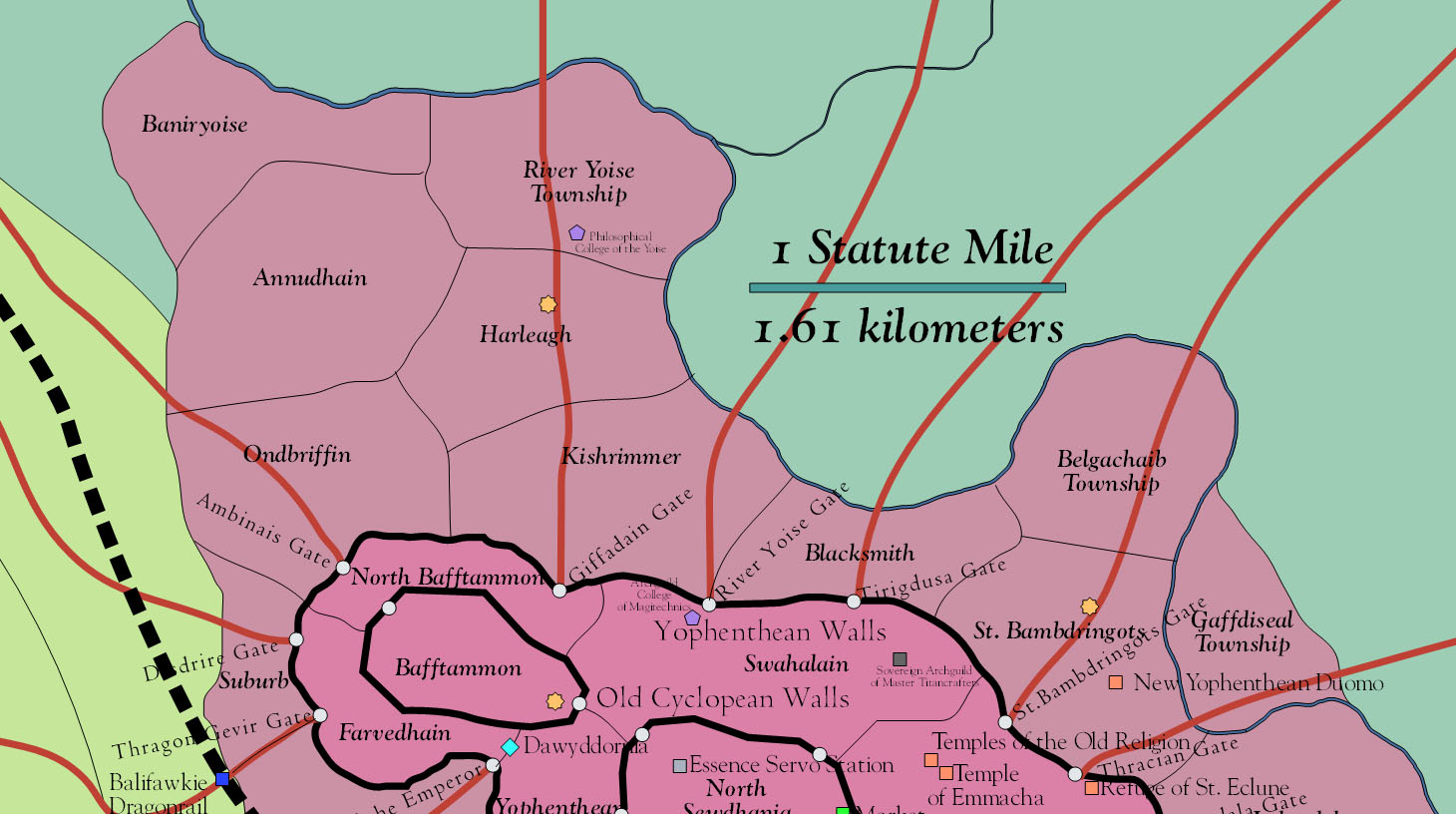
| 18:23, 27 October 2013 | Trevirs-North 2750 001.jpg (file) |  |
200 KB | Screen Capture of the northern districts of the city of Trevirs from regional map. ca 2750. | 1 |
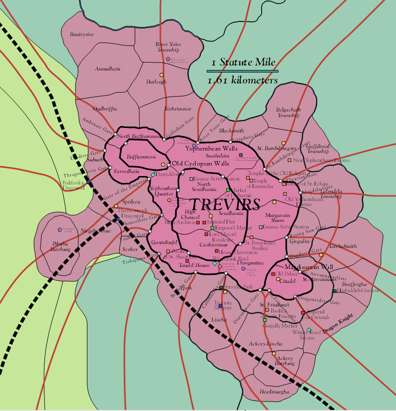
| 18:20, 27 October 2013 | Trevirs 2750 001.jpg (file) |  |
175 KB | Screen Capture of Regional Map of Trevirs, ca. 2750, showing various districts of the immense city. | 1 |
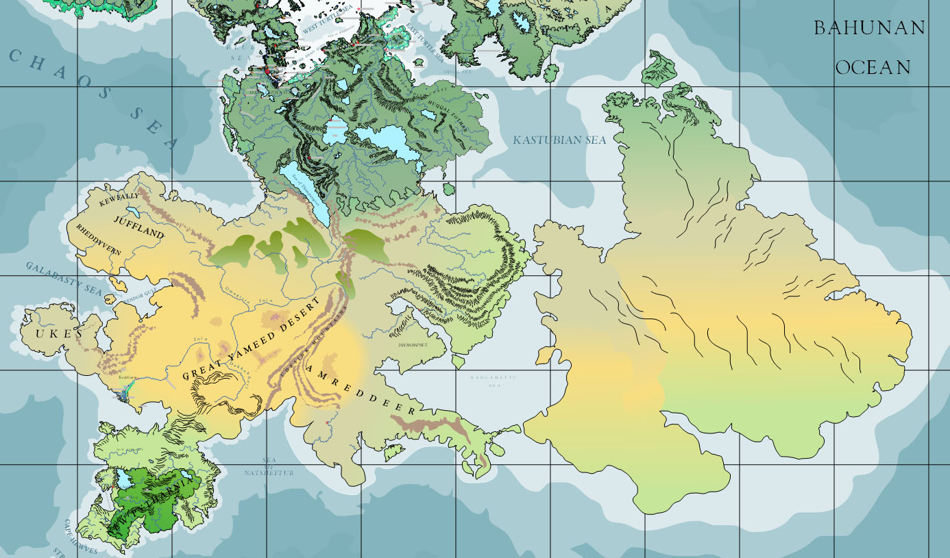
| 18:15, 27 October 2013 | Bahuna&Za-Bahuna 2750 001.jpg (file) |  |
253 KB | Screen Capture of the continents of Bahuna and Za-Bahuna from Asdarah Map, 2750. | 1 |
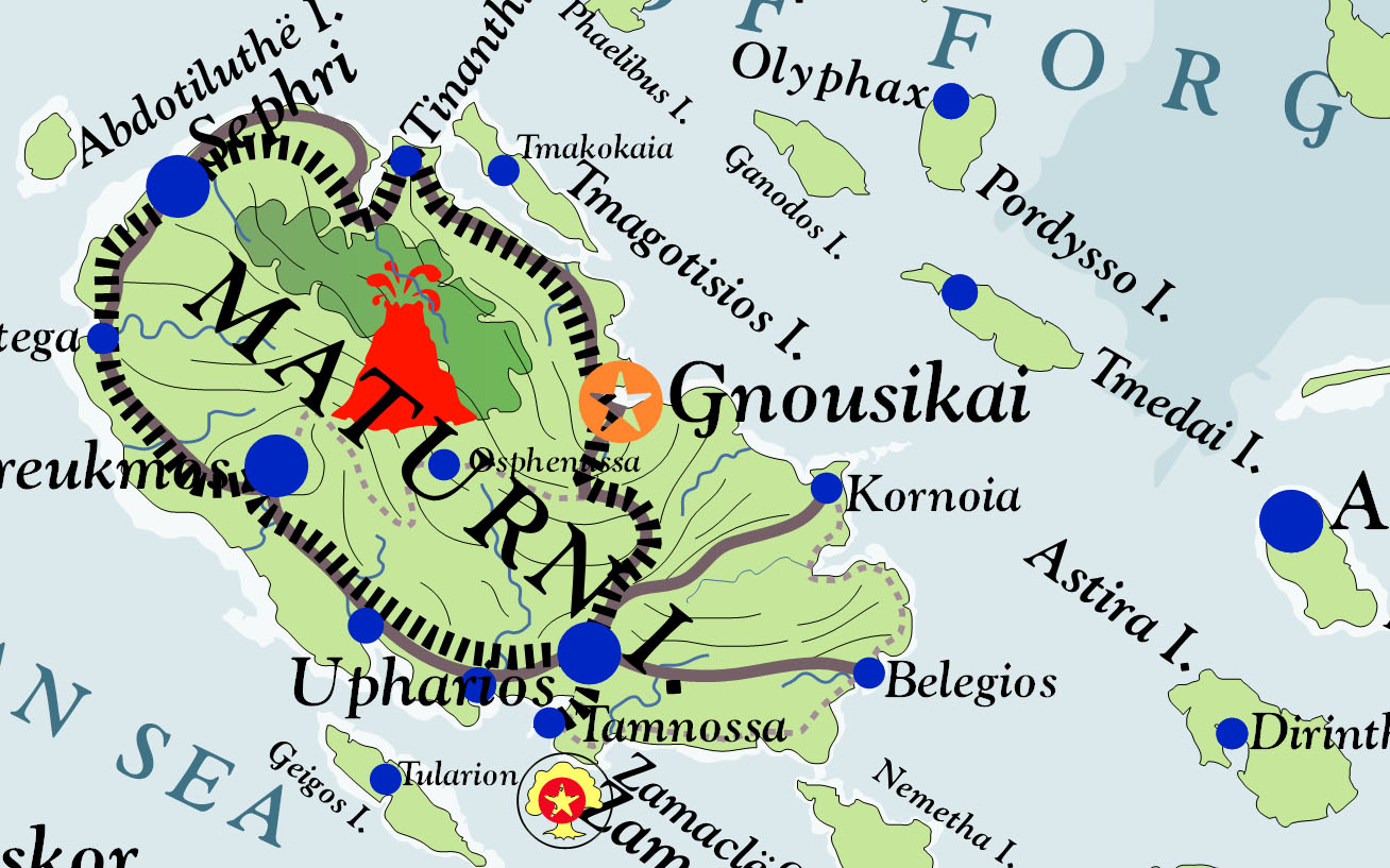
| 18:13, 27 October 2013 | Maturn&NeighboringIslands 2750 001.jpg (file) |  |
242 KB | Screen Capture of Maturn and neighboring islands to the east from Asdarah Map, 2750. | 1 |
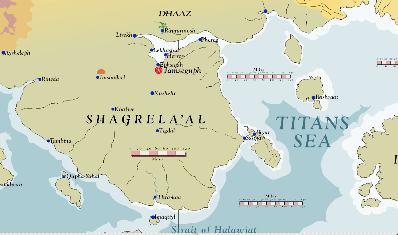
| 18:11, 27 October 2013 | Shagrela'al TitansSea 2750 001.jpg (file) |  |
148 KB | Screen Capture of Shagrela'al from Asdarah Map, 2750. | 1 |
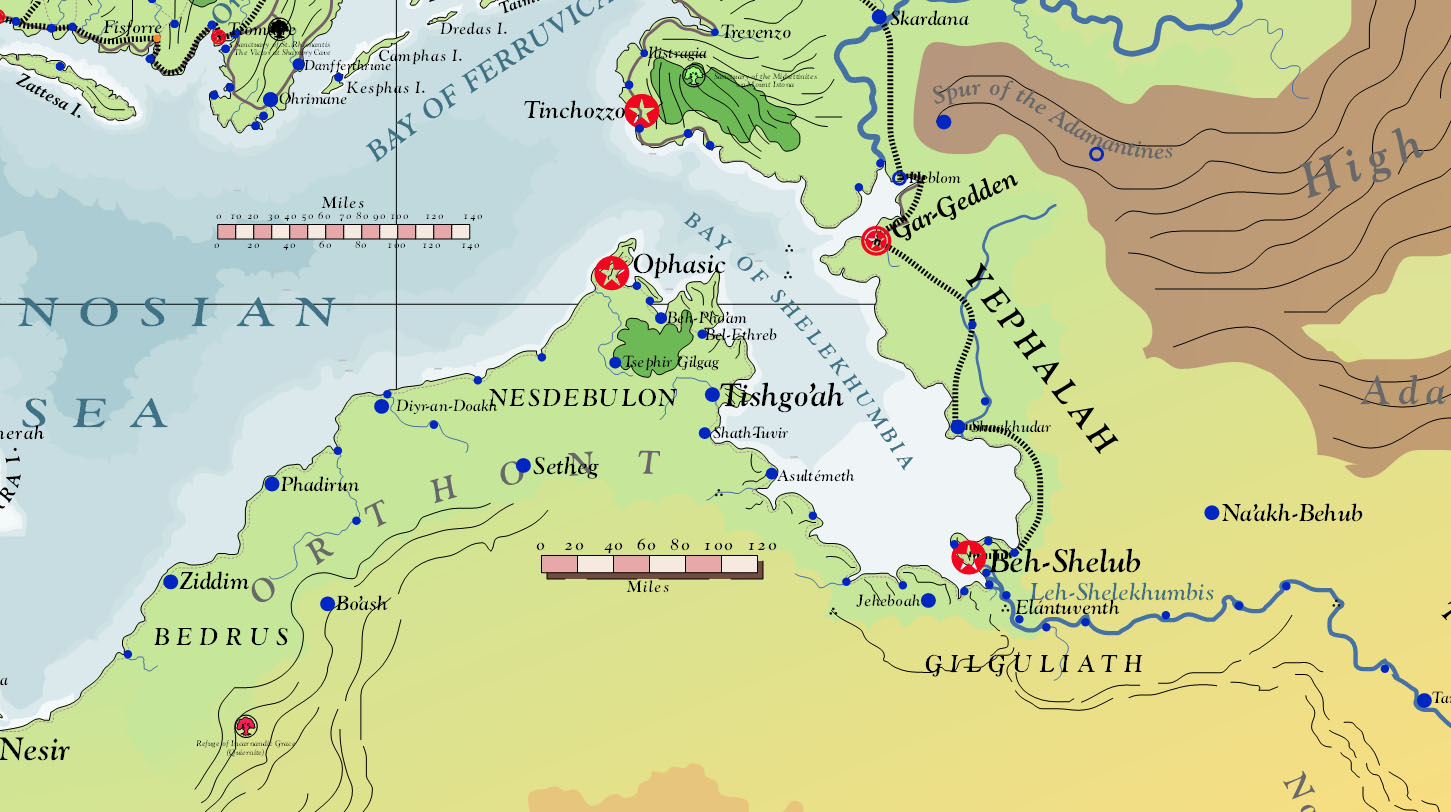
| 18:08, 27 October 2013 | ShelekhumbiaNorthWeshif 2750 001.jpg (file) |  |
226 KB | Screen Capture of Shelekhumbia and North Weshif, 2750, from Asdarah Map. | 1 |
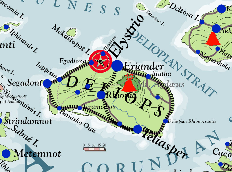
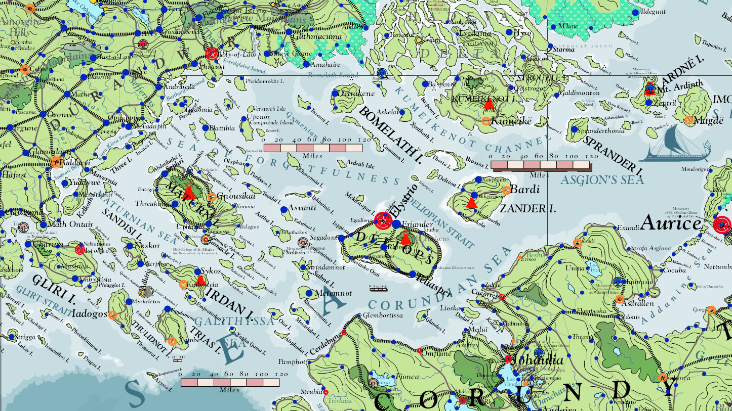
| 18:06, 27 October 2013 | Deliops 2750 001.jpg (file) |  |
148 KB | Screen Capture of Deliops from Asdarah map | 1 |
| 17:55, 27 October 2013 | Gorcorumb 2746 Political 001.jpg (file) |  |
208 KB | Screen Capture of Gorcorumb, Political, 2746, from Asdarah Map. | 1 |
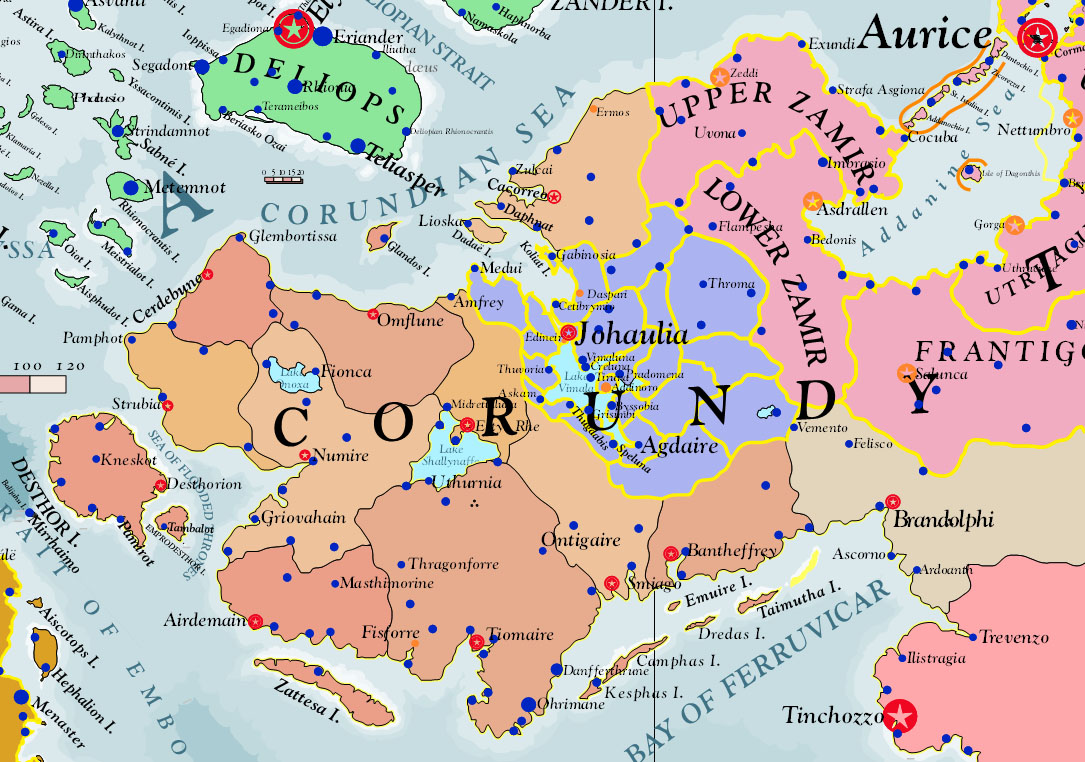
| 17:52, 27 October 2013 | Corundy 2746 Political 001.jpg (file) |  |
288 KB | Screen Capture of Corundy, 2746, Political, from Asdarah Map. | 1 |
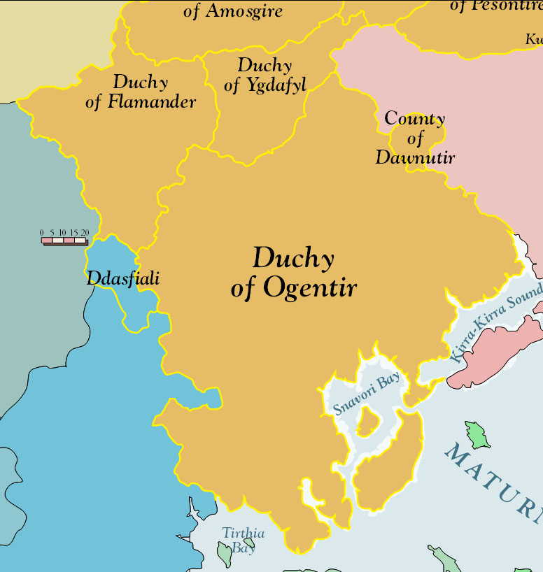
| 17:42, 27 October 2013 | DuchyOgentir 2725 Political 001.jpg (file) |  |
101 KB | Screen Capture of Duchy of Ogentir, 2725, Political, from Asdarah Map. | 1 |
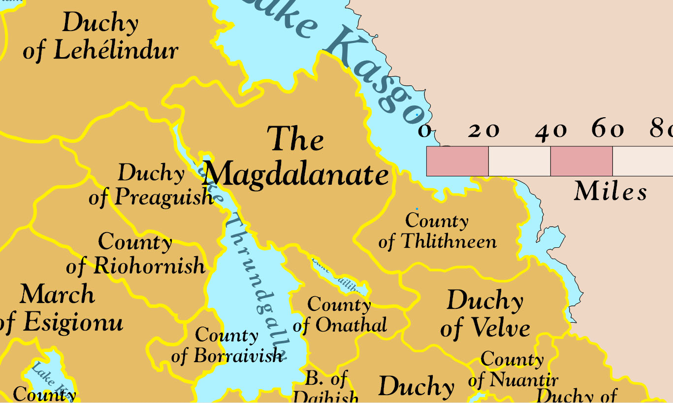
| 17:38, 27 October 2013 | CoreEmpirePytharnia 2725 Political Principalities 001.jpg (file) |  |
204 KB | Screen Capture of Core of Empire of Pytharnia, 2725, showing the Magdalanate and Principalities, Political. | 1 |
| 17:35, 27 October 2013 | SouthernEmpirePytharnia 2725 Political Principalities 001.jpg (file) |  |
238 KB | Screen Capture of Southern Empire of Pytharnia, showing the Principalities, 2725, Political. | 1 |
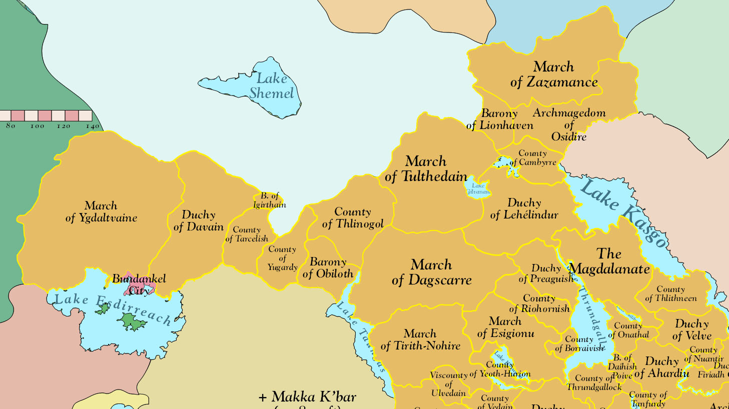
| 17:33, 27 October 2013 | NorthernEmpirePytharnia 2725 Political Principalities 001.jpg (file) |  |
210 KB | Screen Capture of Northern Principalities of Empire of Pytharnia, 2725, Political. | 1 |
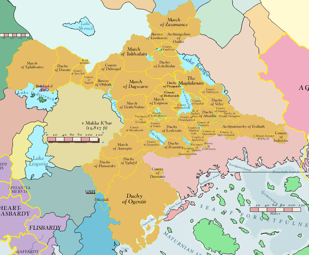
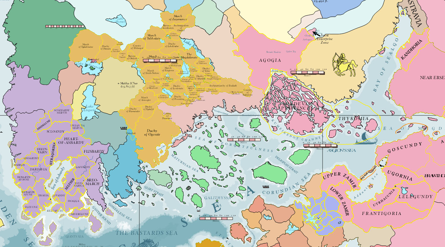
| 17:31, 27 October 2013 | EmpirePytharnia 2725 Political Principalities 001.jpg (file) |  |
217 KB | Screen Capture of Empire of Pytharnia, Political, showing divisions of Principalities. | 1 |
| 17:29, 27 October 2013 | Pytharnia Political 2725 001.jpg (file) |  |
330 KB | Screen Capture of Southern Pytharnia from Asdarah Map. Borders of States in year 2725 AI. | 1 |
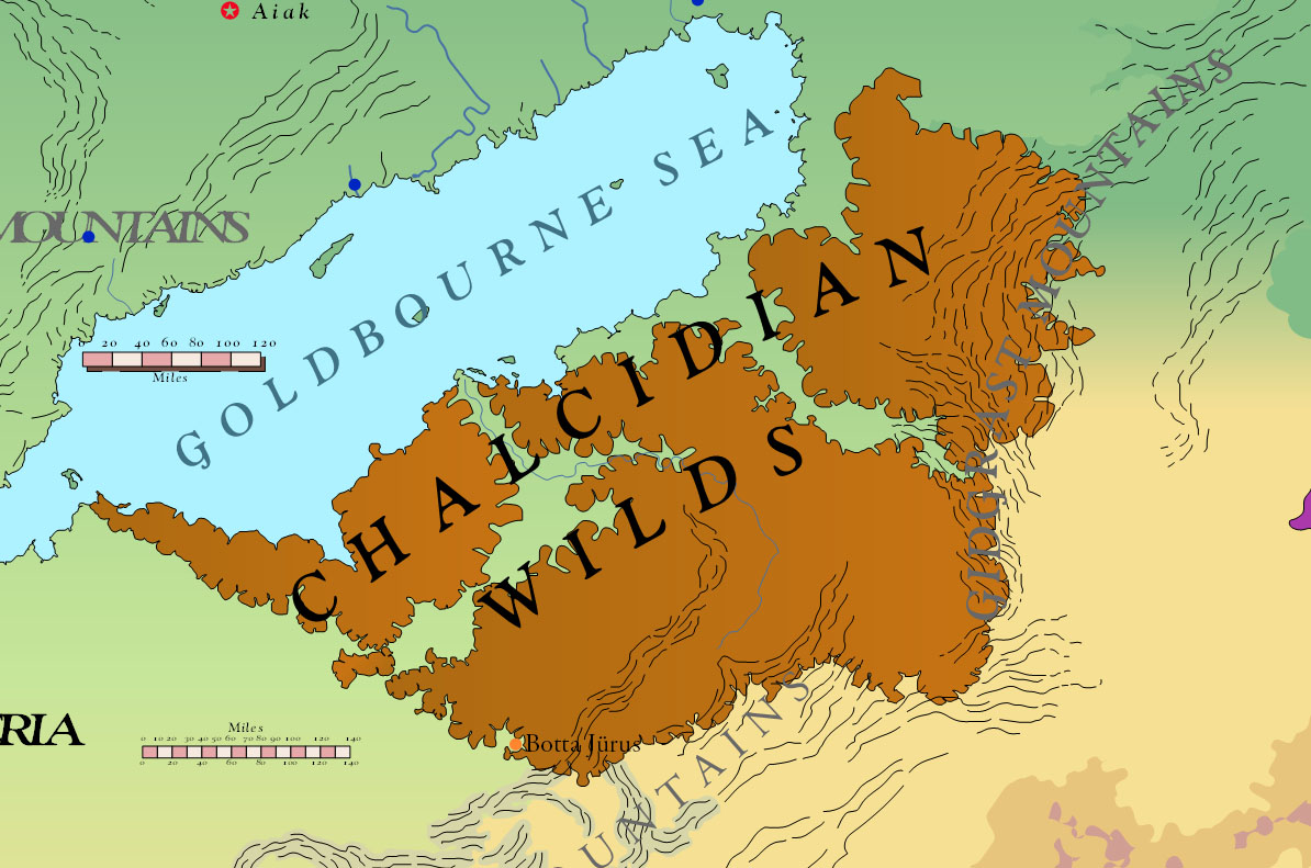
| 17:21, 27 October 2013 | ChalcidianWilds 2750 001.jpg (file) |  |
229 KB | Screen Capture of the Chalcidian Wilds from Asdarah Map. | 1 |
| 17:20, 27 October 2013 | SungotineSea 2750 001.jpg (file) |  |
220 KB | Screen Capture of Sungotine Sea from Asdarah Map. Sea | 1 |
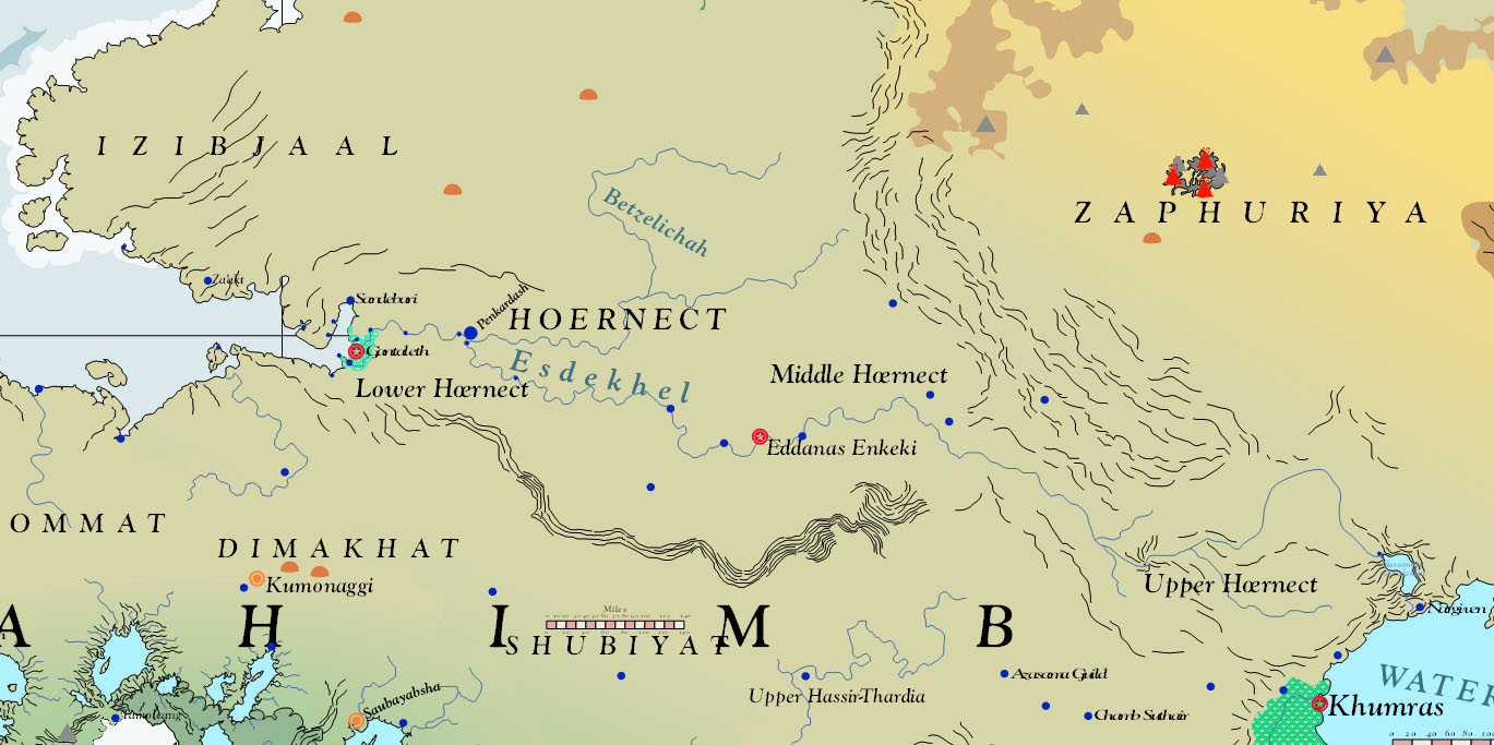
| 17:19, 27 October 2013 | Hœrnect 2750 001.jpg (file) |  |
174 KB | Screen Capture of Hœrnect from Asdarah Map. | 1 |
| 17:18, 27 October 2013 | Sahimb 2750 001.jpg (file) |  |
304 KB | Screen Capture of Sahimb from Asdarah Map. | 1 |
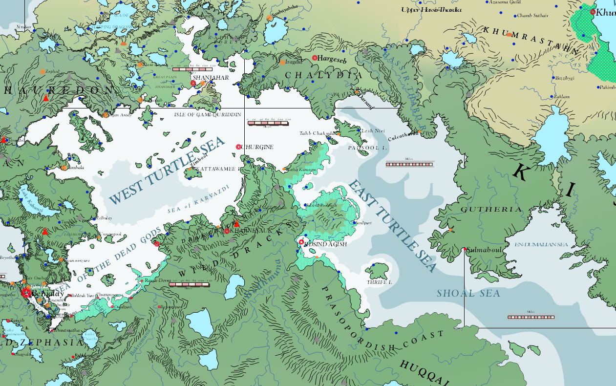
| 17:16, 27 October 2013 | TurtleSea 2750 001.jpg (file) |  |
371 KB | Screen Capture of Turtle Sea from Asdarah Map. Sea | 1 |
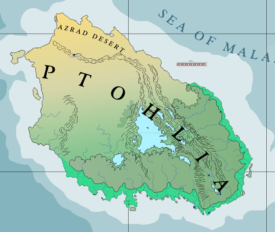
| 17:14, 27 October 2013 | Ptohlia 2750 001.jpg (file) |  |
157 KB | Screen Capture of Ptohlia from Asdarah Map. | 1 |
| 17:12, 27 October 2013 | Orrhymby 2750 001.jpg (file) |  |
212 KB | Screen Capture of Orrhymby from Asdarah Map. Continent | 1 |
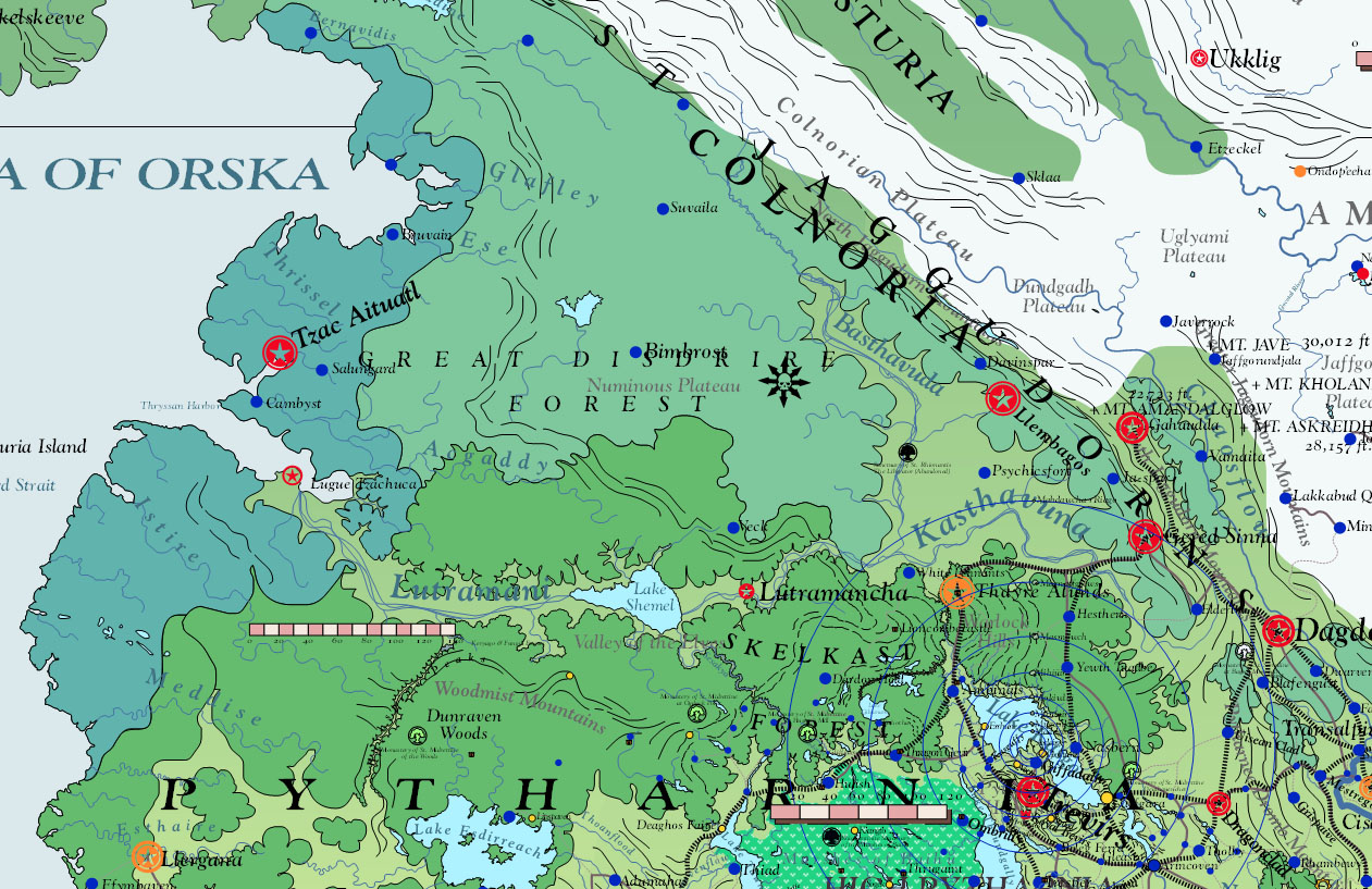
| 17:10, 27 October 2013 | DisdrireForest 2750 001.jpg (file) |  |
405 KB | Screen Capture of Great Disdrire Forest from Asdarah Map | 1 |
| 17:09, 27 October 2013 | IthradMtns AmosgireHills 2750 001.jpg (file) |  |
305 KB | Screen Capture of Ithrad Mountains and Amosgire Hills from Asdarah Map. | 1 |
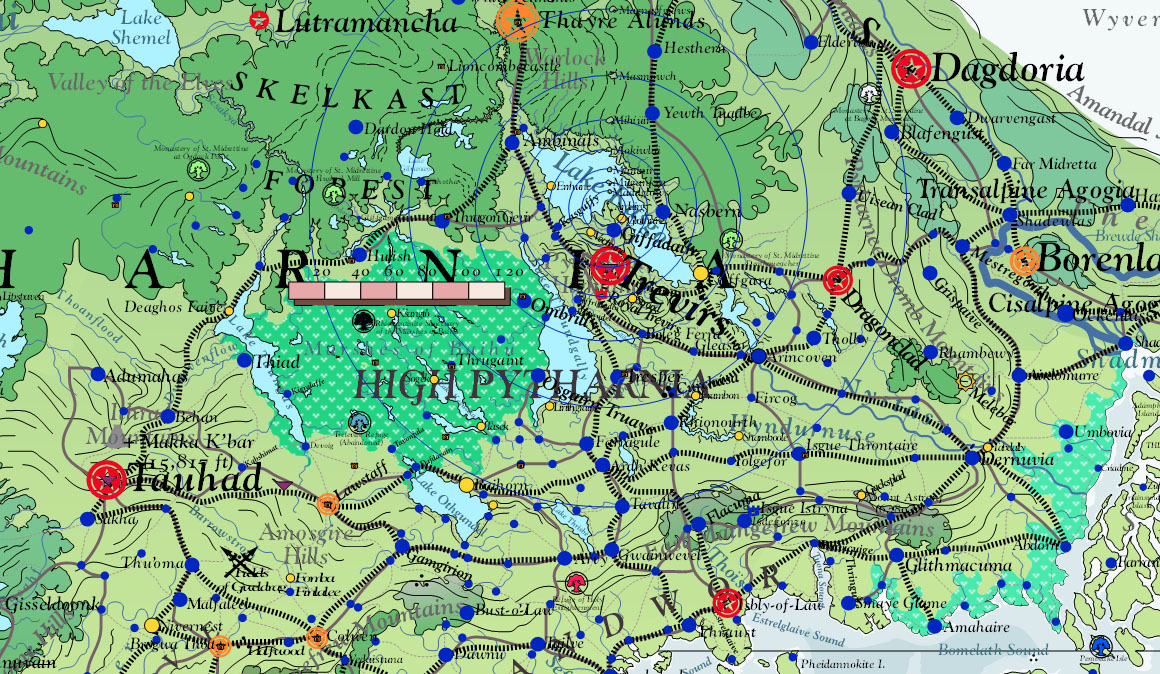
| 17:08, 27 October 2013 | HighPytharnia 2750 001.jpg (file) |  |
458 KB | Screen Capture of High Pytharnia from Asdarah Map. | 1 |
| 17:06, 27 October 2013 | Ambrulia 2750 001.jpg (file) |  |
292 KB | Screen Capture of Ambrulia from Asdarah Map. | 1 |
| 17:04, 27 October 2013 | IthatianIsles 2750 001.jpg (file) |  |
510 KB | Screen Capture of heart of Ithatian Isles from Asdarah Map. | 1 |
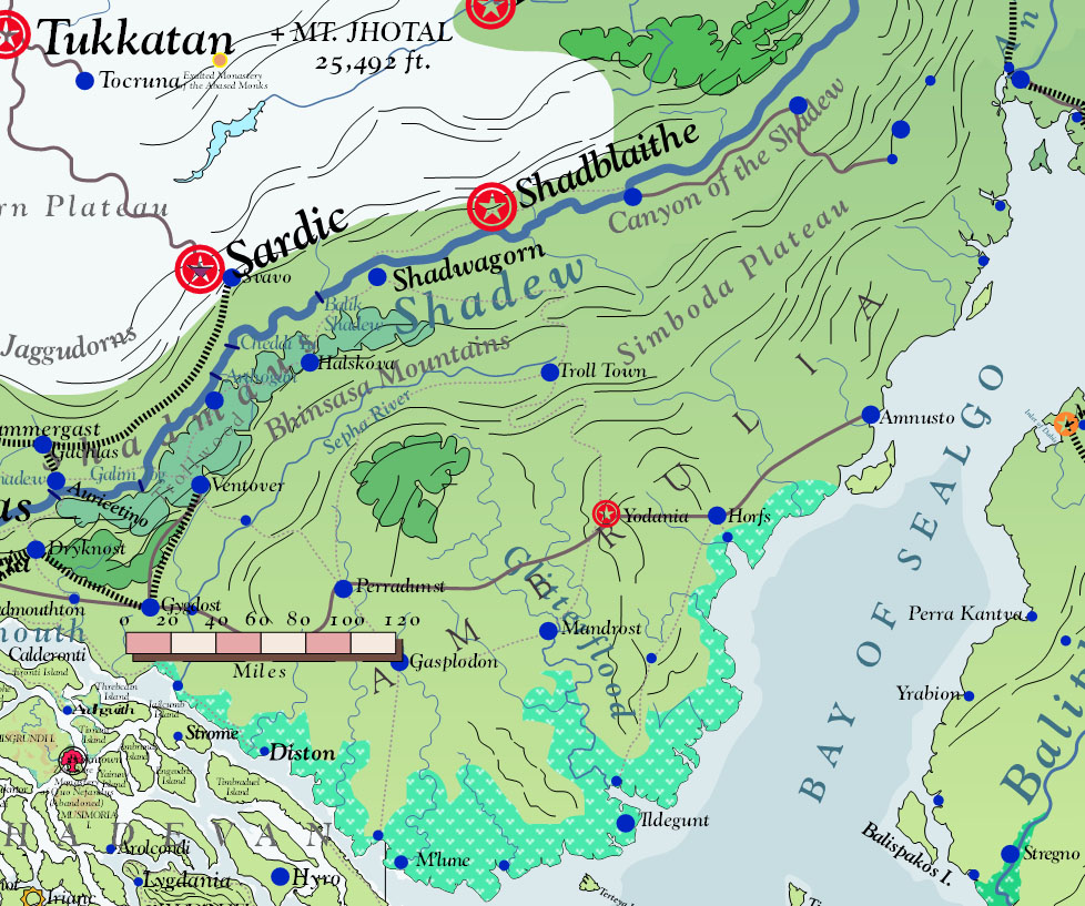
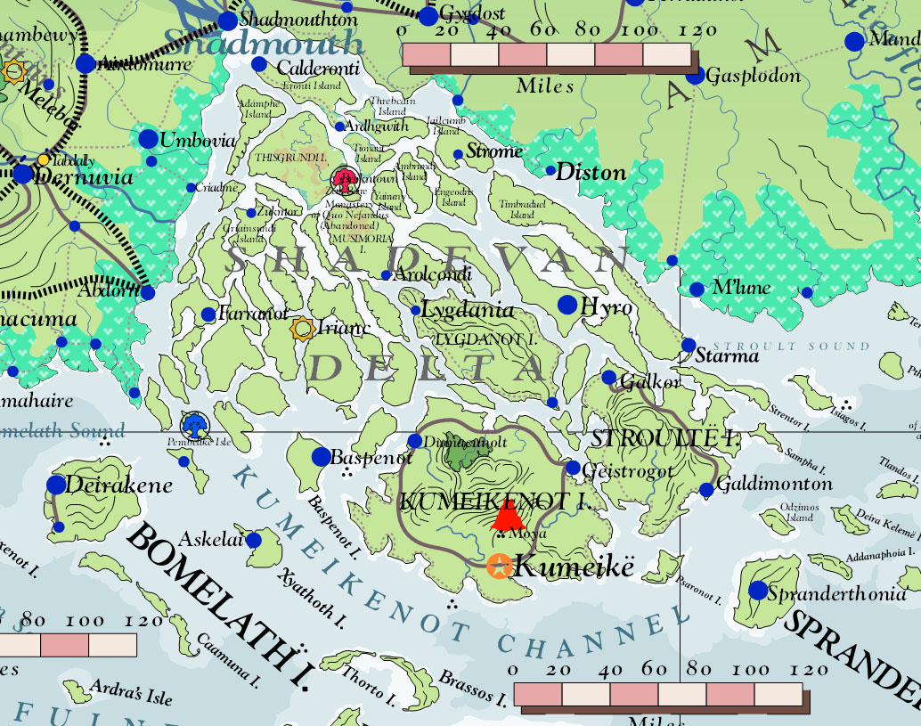
| 17:02, 27 October 2013 | ShadevanDelta 2750 001.jpg (file) |  |
344 KB | Screen Capture of Shadevan Delta from Asdarah Map. | 1 |
| 17:01, 27 October 2013 | Midrardia 2750 001.jpg (file) |  |
266 KB | Screen Capture of Midrardia from Asdarah Map. Continental Bridge | 1 |
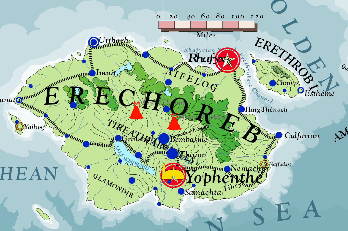
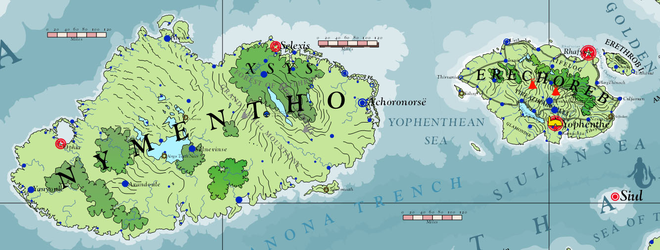
| 16:55, 27 October 2013 | Erechóreb 2750 001.jpg (file) |  |
261 KB | Screen capture of Erechóreb from Asdarah Map. | 1 |
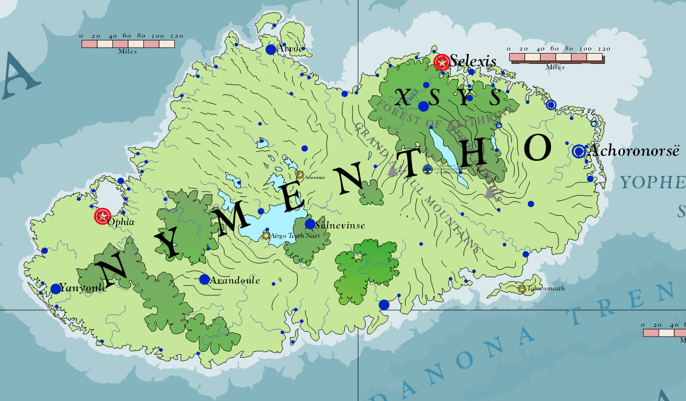
| 16:53, 27 October 2013 | Nymentho 2750 001.jpg (file) |  |
228 KB | Screen Capture of Nymentho from Asdarah Map. | 1 |
| 16:50, 27 October 2013 | GoldenIsles 2750 001.jpg (file) |  |
184 KB | Screen Capture of Golden Isles from Asdarah Map. | 1 |
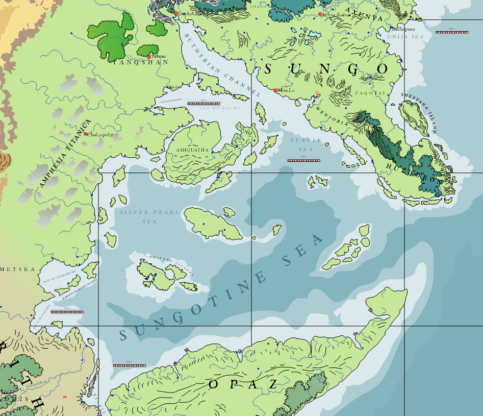
| 16:48, 27 October 2013 | Sungo 2750 001.jpg (file) |  |
255 KB | Screen Capture of Sungo from Asdarah Map. | 1 |
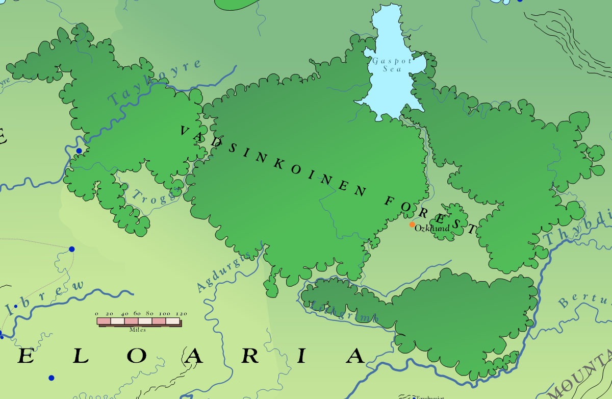
| 16:45, 27 October 2013 | VadsinkoinenForest 2750 001.jpg (file) |  |
168 KB | Screen Capture of Vasdinkoinen Forest from Asdarah Map. | 1 |
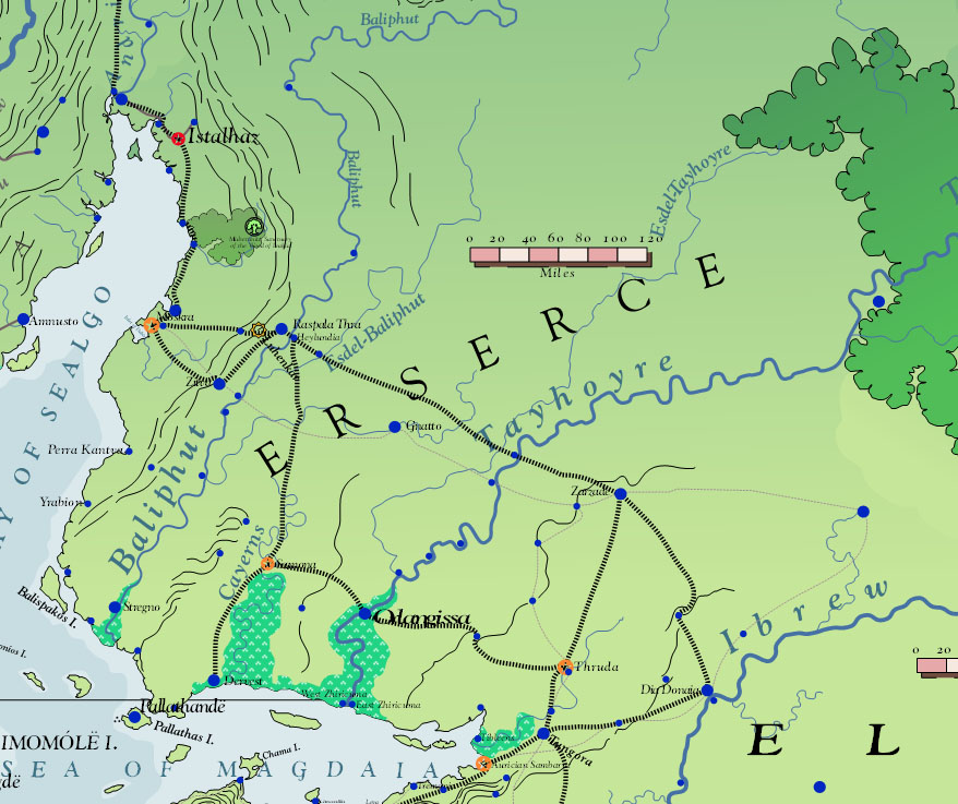
| 16:43, 27 October 2013 | Erserce 2750 001.jpg (file) |  |
174 KB | Screen Capture of Erserce from Asdarah Map. | 1 |
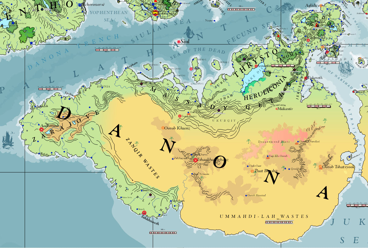
| 16:41, 27 October 2013 | Danona 2750 001.jpg (file) |  |
306 KB | Screen Capture of Danona from Asdarah Map. | 1 |
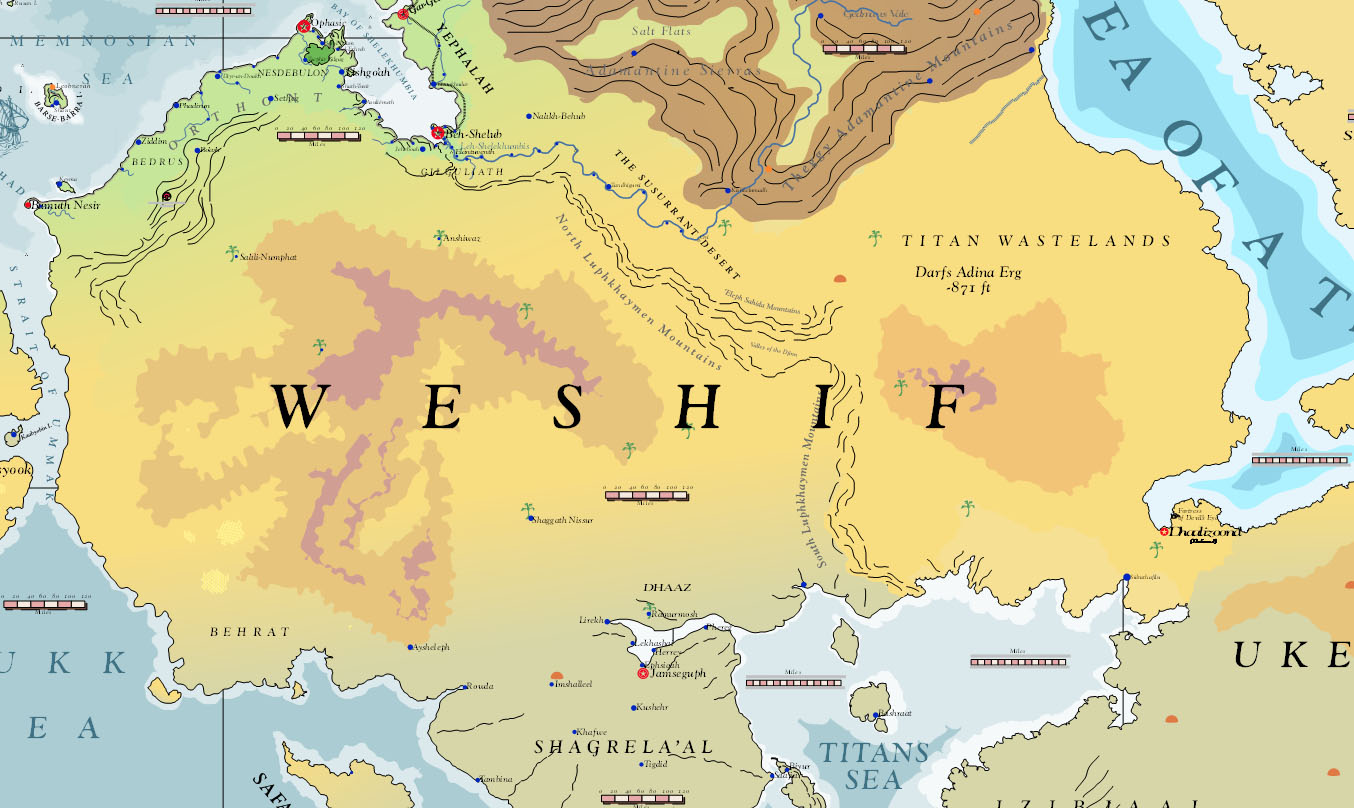
| 16:40, 27 October 2013 | Weshif 2750 001.jpg (file) |  |
207 KB | Screen Capture of Weshif from Asdarah Map. | 1 |
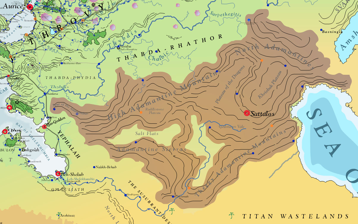
| 16:38, 27 October 2013 | AdamantineMountains 2750 001.jpg (file) |  |
272 KB | Screen capture of Adamantine Mountains from Asdarah Map. | 1 |
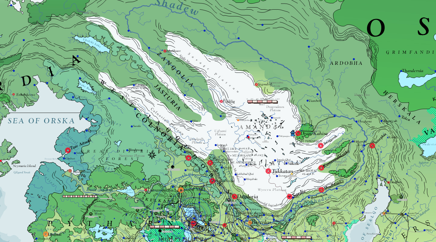
| 16:36, 27 October 2013 | Pytharnia 2750 001.jpg (file) |  |
487 KB | Screen Capture of Pytharnia from Asdarah Map. Subcontinent | 1 |
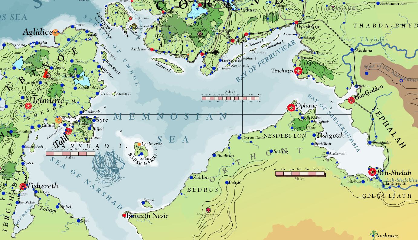
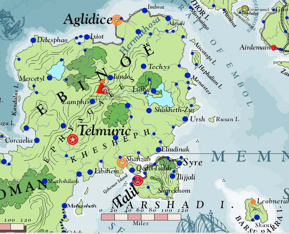
| 16:27, 27 October 2013 | MemnosianSea 2750 001.jpg (file) |  |
324 KB | Screen capture of Memnosian Sea from Asdarah map | 1 |
| 16:20, 27 October 2013 | Ambrinqua 2750 001.jpg (file) |  |
262 KB | Screen capture of the Ambrinquan Peninsula from Asdarah Map | 1 |
| 16:19, 27 October 2013 | Corundy 2750 001.jpg (file) |  |
432 KB | The Peninsula of Corundy | 1 |
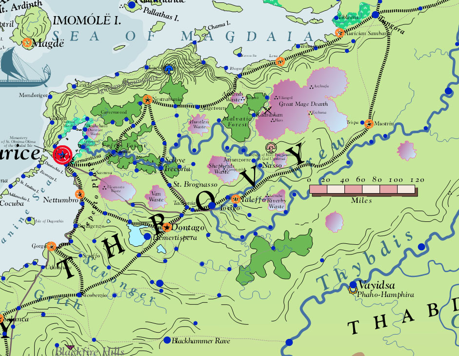
| 16:17, 27 October 2013 | Throvy 2750 001.jpg (file) |  |
264 KB | Throvy at the core of the Aurician Empire | 1 |
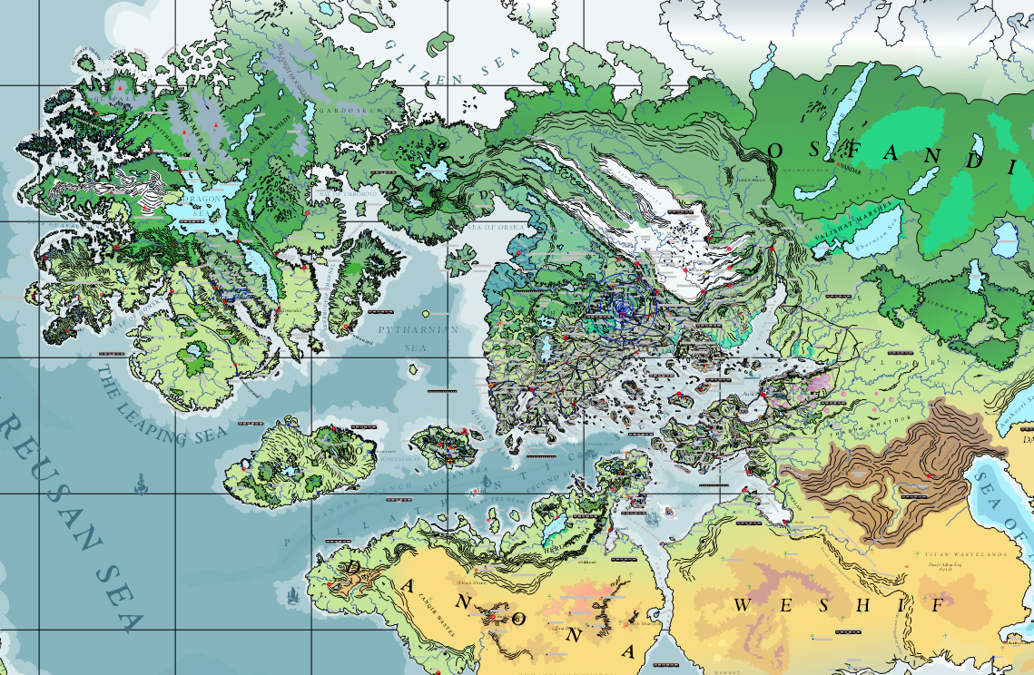
| 21:22, 26 October 2013 | GreaterPallathanticRegion 001.jpg (file) |  |
783 KB | Screen Capture of Asdarah Old World Map: Greater Pallathantic Region, including Barathorn, Midrardia, Jaggudorns, Pytharnia, West Osfandia, Eloaria, Corundy, Throvy, Shelekhumbia, Ithatia, Danona, Erechóreb, Nymentho, Northwest Weshif | 1 |
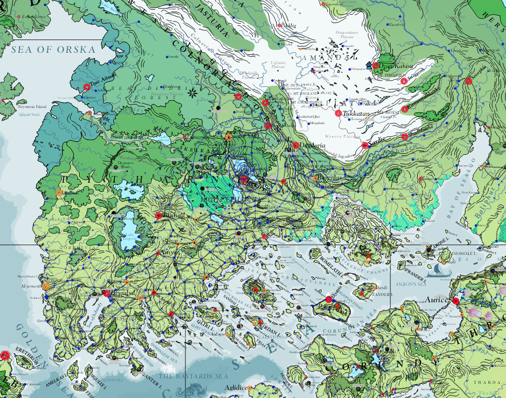
| 21:04, 26 October 2013 | Jaggudorns 2750 001.jpg (file) |  |
808 KB | The Jaggudorn Mountains were formed before human history by the collision of the subcontinent of Pytharnia with the greater continent of Asdauria. | 1 |
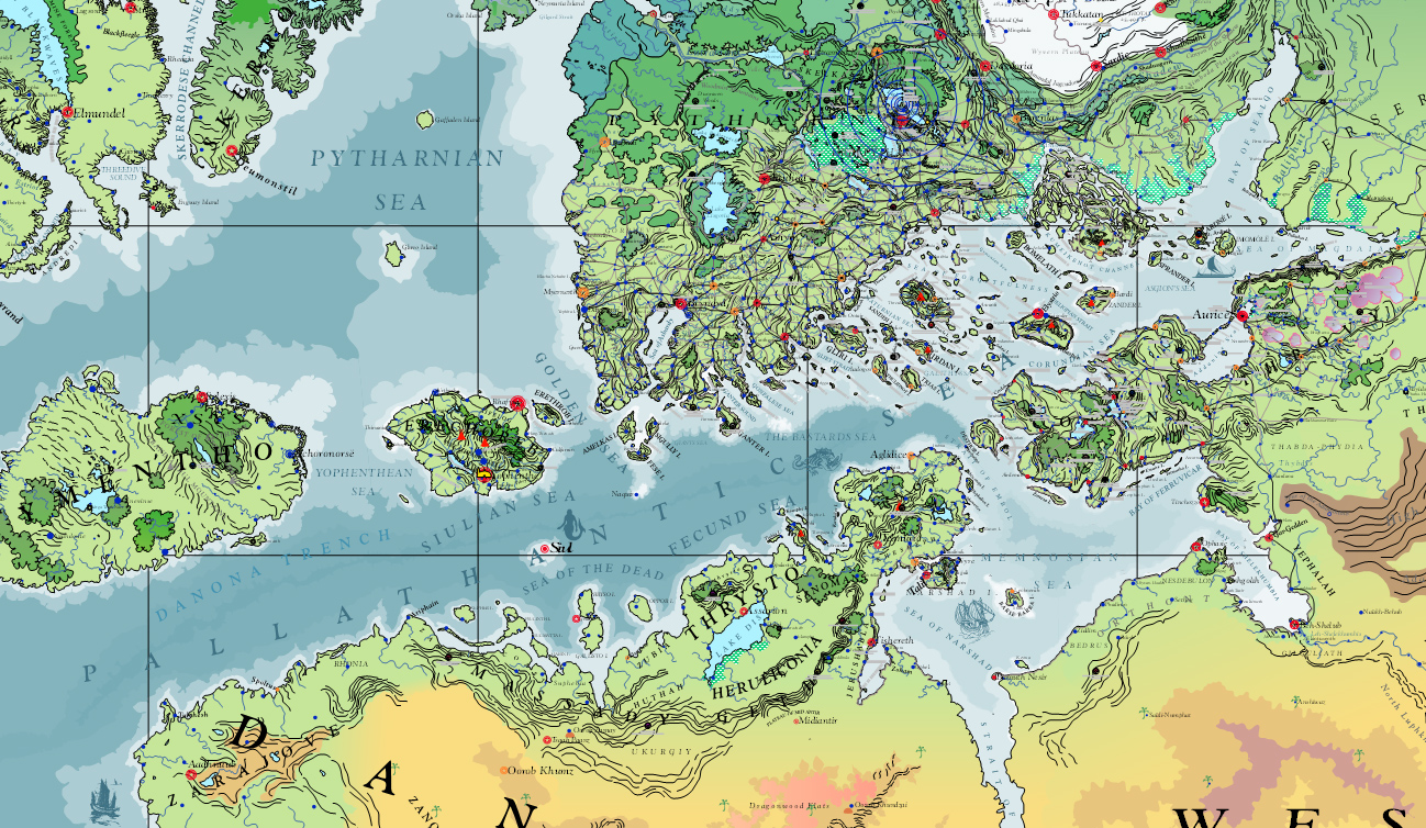
| 20:51, 26 October 2013 | PallathanticSea 2750 001.jpg (file) |  |
894 KB | The Pallathantic Sea and surrounding lands in the year 2750 AS | 1 |