Difference between revisions of "High Shadevan Plateau"
Jump to navigation
Jump to search

Trismegistus (talk | contribs) (created) |
Trismegistus (talk | contribs) m |
||
| Line 1: | Line 1: | ||
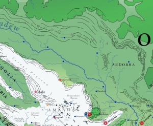
[[File:MapHighShadevanPlateau.jpg|thumb|300px|The High Shadevan Plateau drains by means of the [[Shadevan River]].]] | [[File:MapHighShadevanPlateau.jpg|thumb|300px|The High Shadevan Plateau drains by means of the [[Shadevan River]].]] | ||
| − | The High Shadevan Plateau rests to the northeast of the [[Jaggudorns]] and is the land through which the [[Shadevan River]] flows. The [[Jashund Mountains]] form the northeast boundary of the plateau and separate the plateau from [[Osfandia]]. | + | The High Shadevan Plateau rests to the northeast of the [[Jaggudorns]] and is the land through which the [[Shadevan River]] flows. The [[Jashund Mountains]] form the northeast boundary of the plateau and separate the plateau from [[Osfandia]]. It is called the High Shadevan Plateau to distinguish it from the [[Canyon of the Shadew]], the [[Shadmaus]], and the [[Shadmouth]] which are relatively lower in elevation. |
=See Also= | =See Also= | ||
Revision as of 11:46, 9 July 2014

The High Shadevan Plateau drains by means of the Shadevan River.
The High Shadevan Plateau rests to the northeast of the Jaggudorns and is the land through which the Shadevan River flows. The Jashund Mountains form the northeast boundary of the plateau and separate the plateau from Osfandia. It is called the High Shadevan Plateau to distinguish it from the Canyon of the Shadew, the Shadmaus, and the Shadmouth which are relatively lower in elevation.
See Also
- Ardobha
- Dagunyami Plateau
- Idmuse Pass
- Jaggudorn Mountains
- Savage Plateau
- Shadew River
- Thrace
- Thracian Plateau
| This article is a stub. It requires further development by the creator. |