Difference between revisions of "Asdarography"
Jump to navigation
Jump to search
Trismegistus (talk | contribs) m (→The Oceans) |
Trismegistus (talk | contribs) m (→The Oceans) |
||
| Line 32: | Line 32: | ||
*[[Pytharnian Sea]] | *[[Pytharnian Sea]] | ||
*[[Sea of Malankhas]] | *[[Sea of Malankhas]] | ||
| − | ;[[Austral | + | ;[[Austral Ocean]] |
| − | |||
;[[Boreal Ocean]] | ;[[Boreal Ocean]] | ||
*[[Bardost Sea]] | *[[Bardost Sea]] | ||
Revision as of 22:36, 14 January 2015
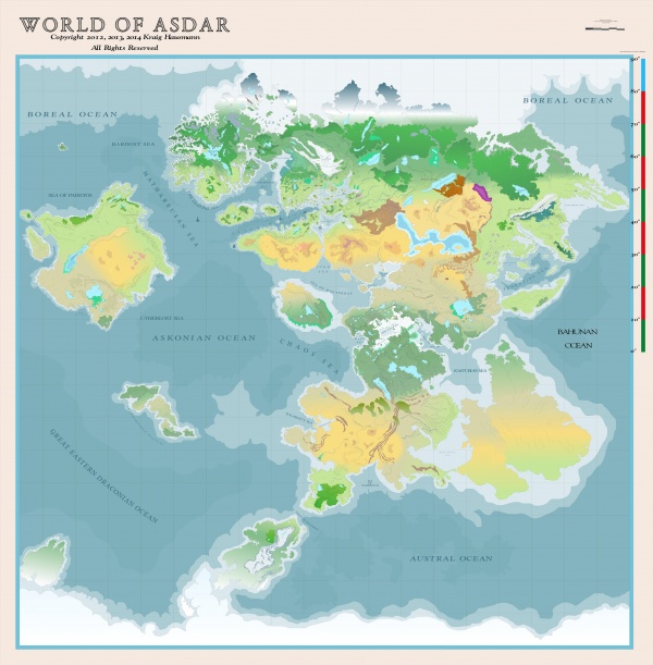
Asdarography encompasses the study of the various lands and regions of the world of Asdar and an asdarographer is one so engaged. In its more technical aspects, it comprises the mathematical measurement of distances upon the surface of Asdarah. Asdarography includes the study of cartography.
The Continents
The Oceans
PDF Maps
- Asdarah Old World Map PDF (This PDF is over 10MBs in size)
See Also
| This article is a stub. It requires further development by the creator. |
